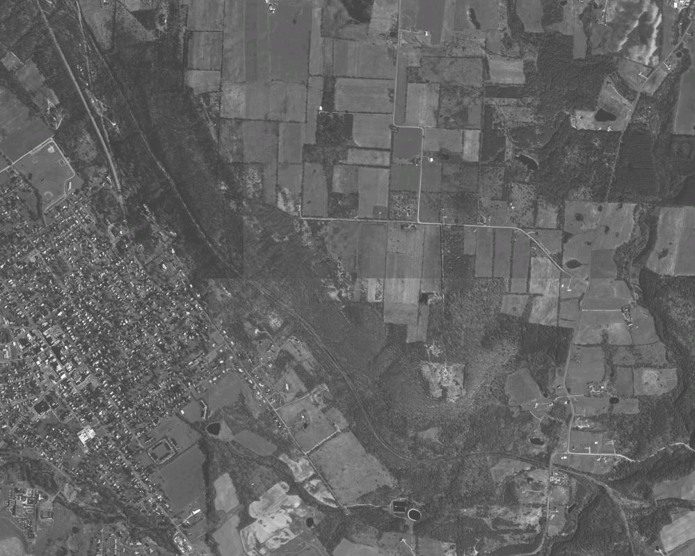
Dansville
Dansville Launch
Rules
- Requires RAF membership
- Requires current intermediate rating
- Novice rated pilots require direct supervision by a pilot familiar with the site
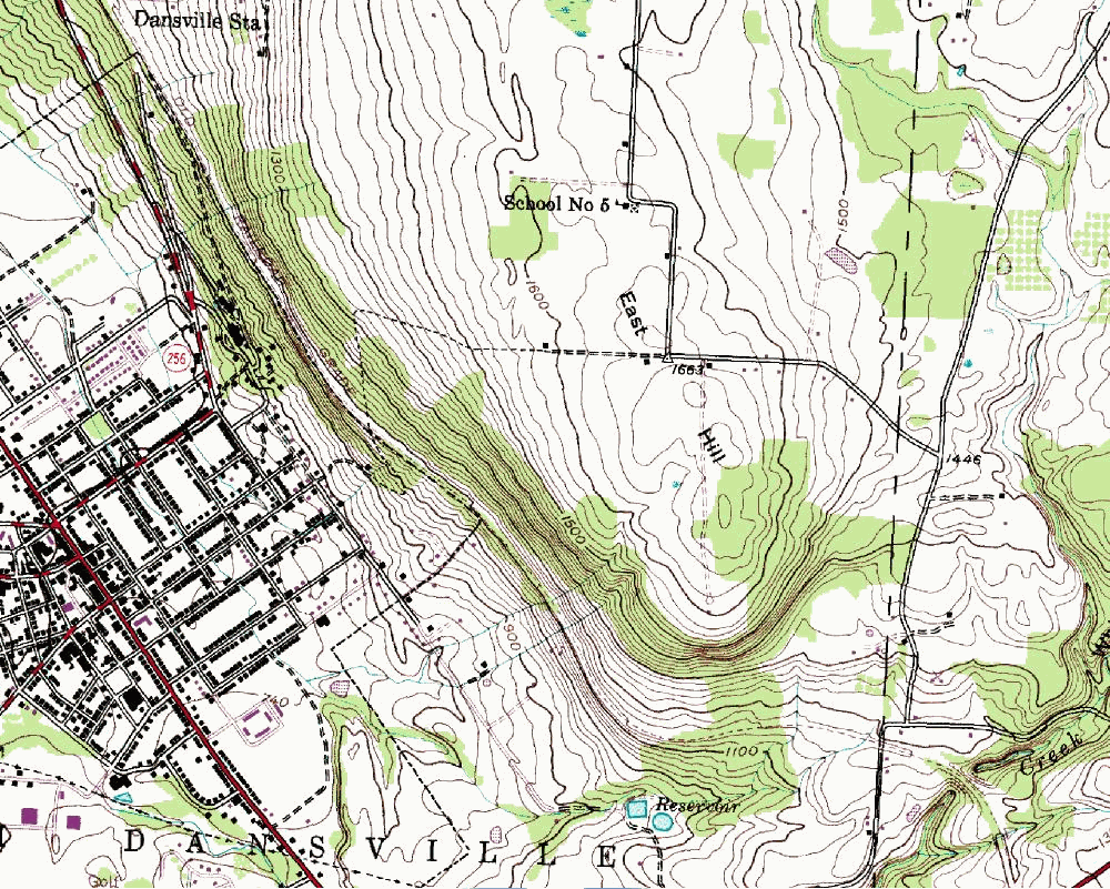
Location/Directions
- I-390 to Dansville
- Take Exit 4
- Left onto 36 (regardless of N/S direction on 390)
- Turn right onto Main St/ 63 South (about 1 mile)
- Left onto Sahrles Road (about 1 mile)
- Bear left, onto Mendoleine Road, at the S Bend in the road (about 1.3 miles up hill)
- Left onto Sterner Road (about 1/2 mile), which becomes McNeil Rd
- # 6286 on left, paved driveway, green Maplelane Stables sign (cutout shape of maple leaf)
- Drive slowly toward house, then carefully across lawn toward barn.
- Park in woods, off laneway to right of barn (leave laneway clear)
- Walk down the laneway "path" to the launch
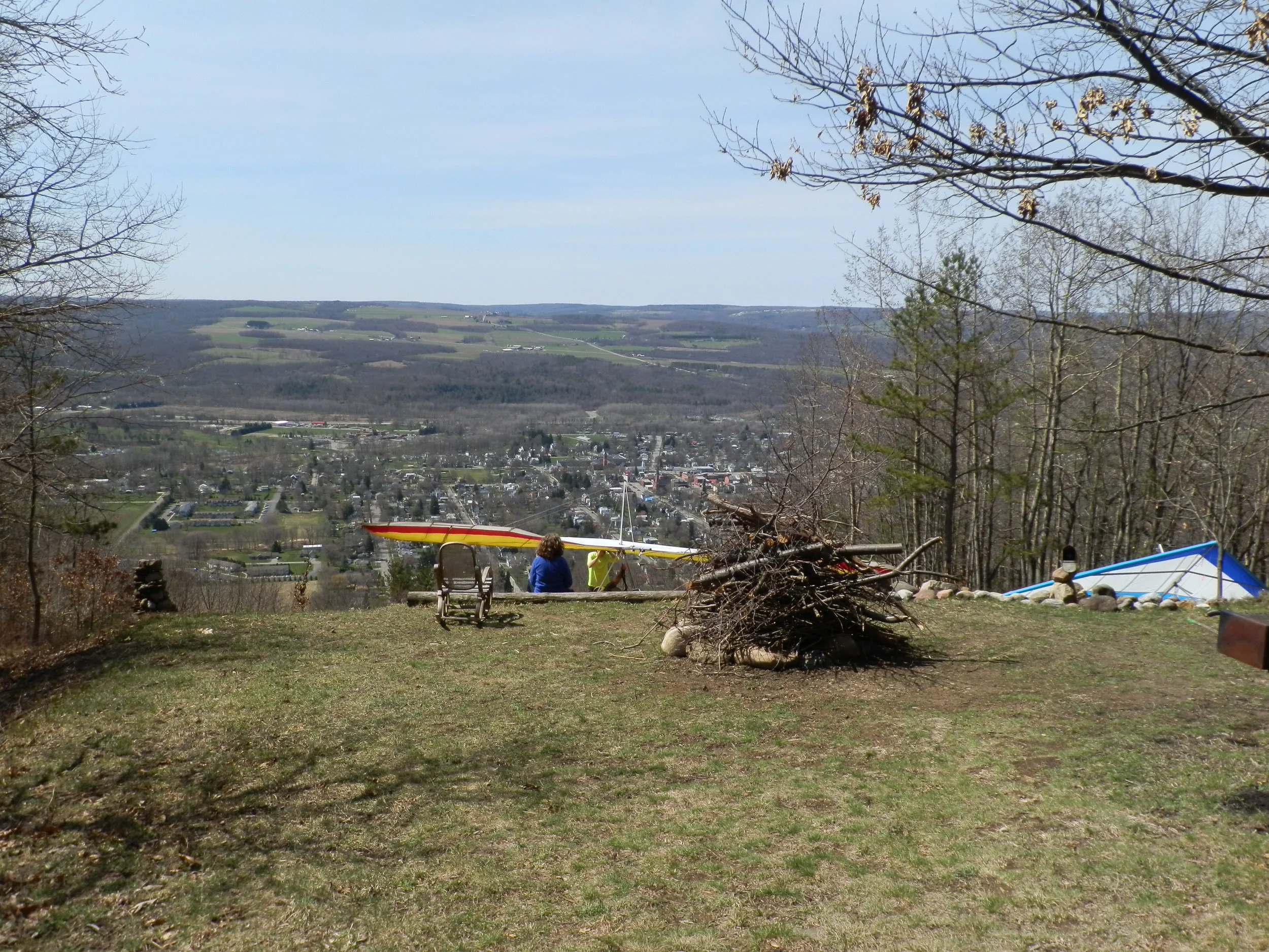
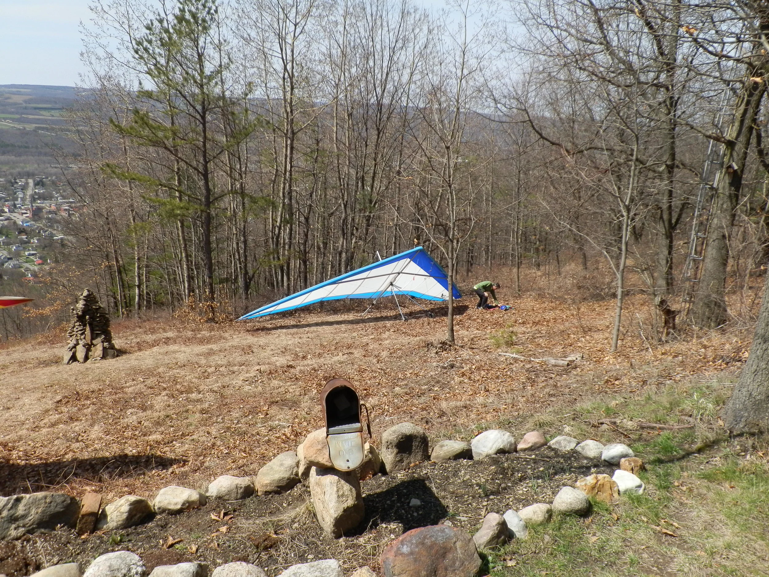
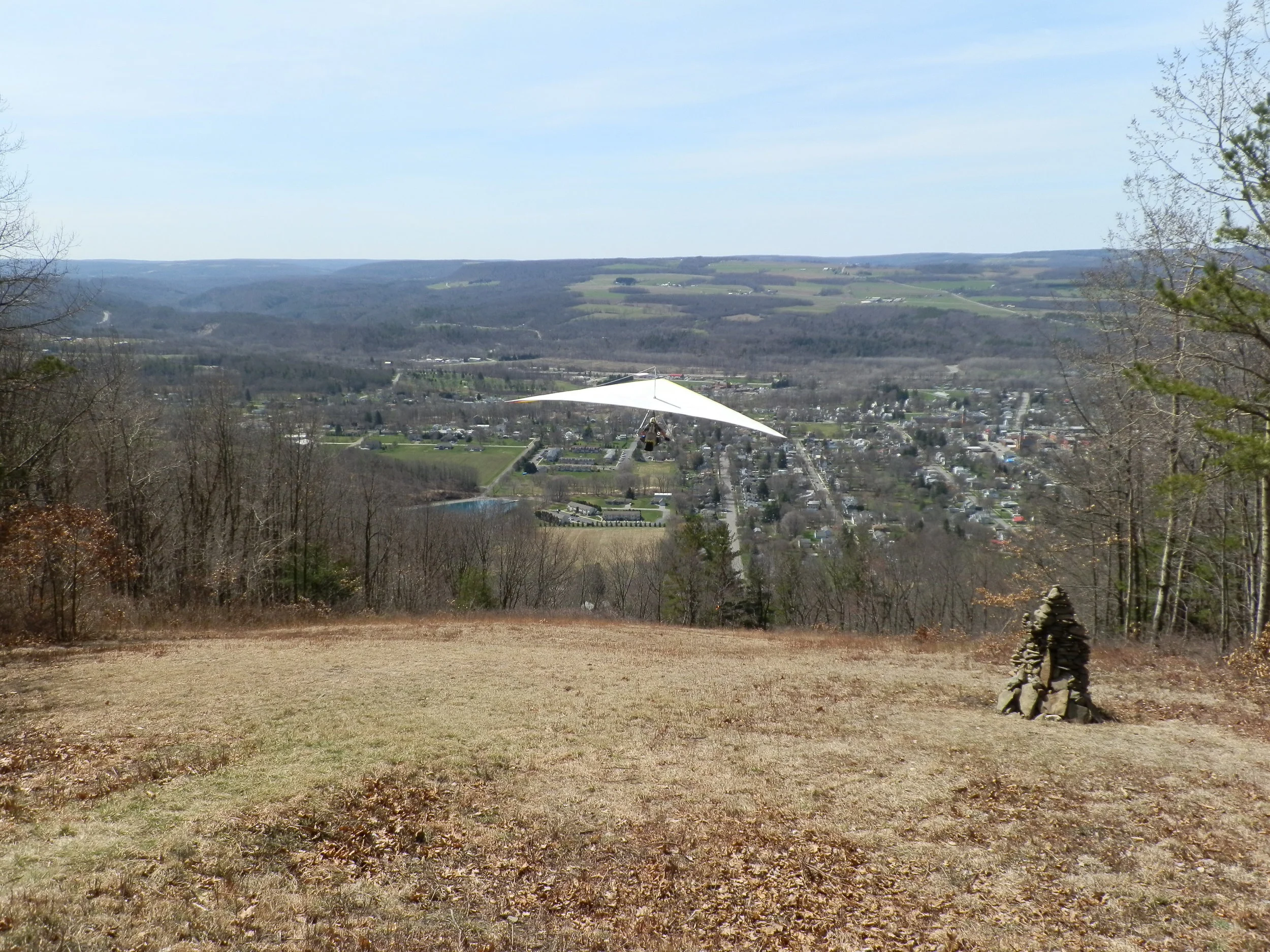
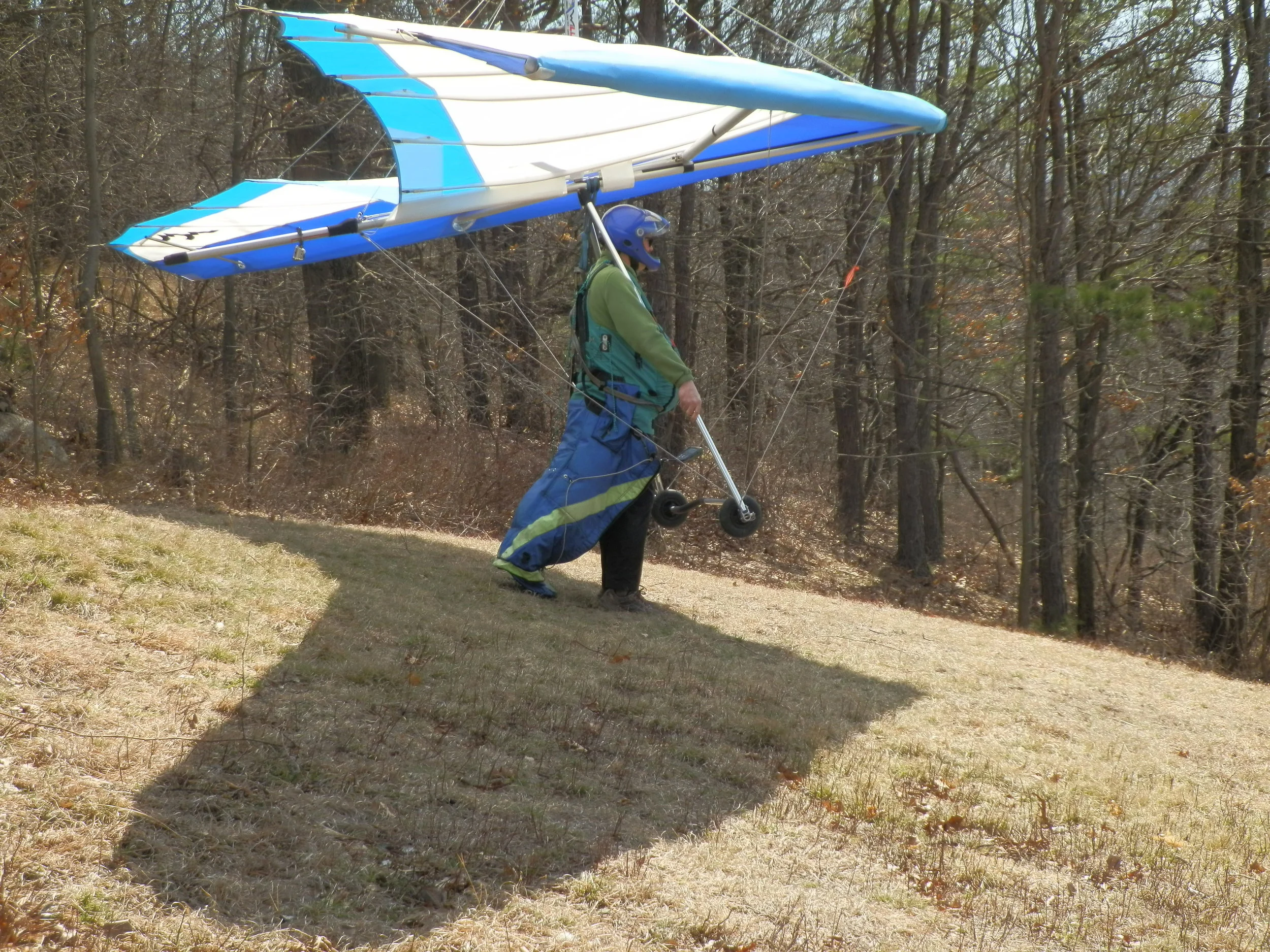
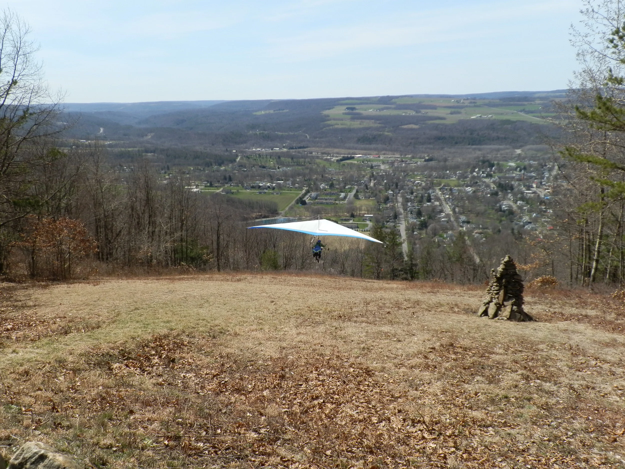
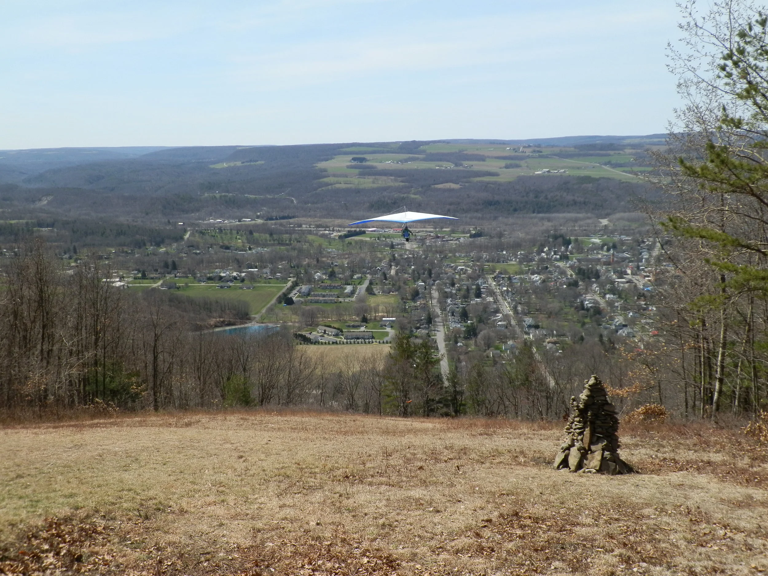
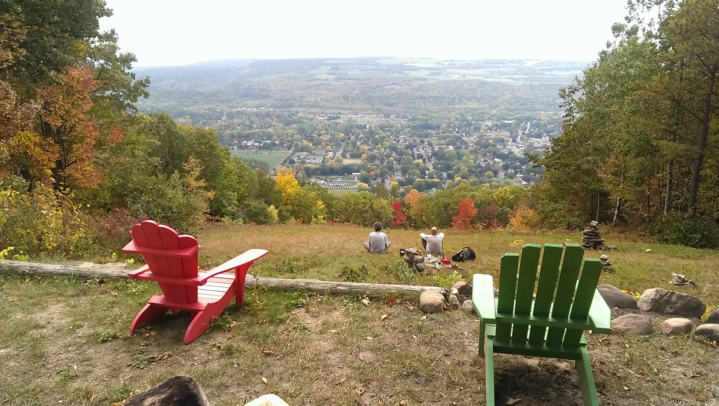
Launch
- 1560 MSL
- Shallow Slope Launch
- West South West
- Setup allows approximately 5-7 gliders to be set up at any one time
- Beware of turbulence at launch due to cross winds
- Beware of turbulence after launch due to sheer cliff face to left
- Shallow slope launch technique required
Landing
- Primary LZ
- 880 MSL
- 10 acres in front of south end of ridge
- Interstate 390 exit 4, then left onto Rt. 36 north
- Turn right onto Main St /Rt 63 south
- Turn Left on Liberty St, 2 blocks turn right on Cottage Street.
- Continue to Park Hill Apartments
- LZ is the field next to the apartments
- DO NOT PARK ON THE GRASS
- Alternate LZ (SW of Apartment LZ)
- ame directions to Main St/ Rt 63 south (as above)
- Turn left on Kyle, go one block
- Right on Matthews Trail
- Park along Matthews Trail
- Do not drive beyond gate on Kyle.
- Top Landing behind launch is OK if no crop is planted
- The top field slopes toward launch
- Landing cross wind (diagonal to the ridge) is recommended
Flying
- Beware of sailplane and airplane traffic
- Airport in valley to the North
- Soarable in SW-W wind
Camping
- Many campgrounds
- Recommend Stony Brook State Park 4 miles South of Dansville on Rt 63